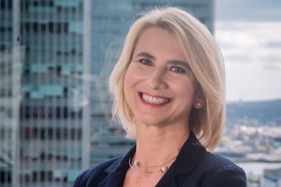
Xcalibur Multiphysics Group CEO Andres BLANCO:
KAZAKHSTAN CAN BECOME A REGIONAL LEADER IN MINERAL EXPLORATION
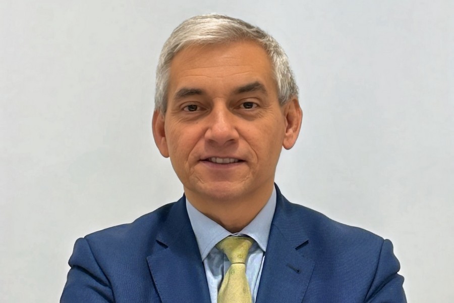
Kazakhstan is going to hire Spain-based Xcalibur Multiphysics Group to make an updated map of its mineral deposits as part of a national project for geophysical mapping of the republic’s territory. A memorandum of understanding has already been signed with Kazakhstan’s National Geological Service to implement the first phase of the project in the Northern Pre-Balkhash area. This part of the project will be financed by the Spanish government. Full mapping of the country could take up to six years and may lead to the discovery of new deposits. Xcalibur Multiphysics Group CEO Andres BLANCO unveiled the details of the mapping project in an interview with Interfax-Kazakhstan News Agency.
- Which projects are you currently implementing in Kazakhstan? And why did you choose Kazakhstan specifically? Why did you decide to base your company here to manage regional projects across Central Asia?
- I’ll start with the second question, as it relates more directly to our strategic vision. We are the global leader in natural resource mapping using airborne geophysics and remote sensing technologies. Our strategy is to decentralize operations and establish hubs in regions with strong geological potential.
One such region is Central Asia, and within it, we identified Kazakhstan as the ideal location to serve as our regional hub - primarily due to its geopolitical position, stability, and access to surrounding markets.
This means we are not here for short-term or speculative reasons, nor are we here just to serve two or three clients. Our presence in Kazakhstan is a long-term commitment to build a solid operational base for the entire region.
We began our operations in Kazakhstan in 2022 and officially opened our office in 2023, if I’m not mistaken. Since then, we’ve been working with several local companies, many of which are subsidiaries of international mining corporations we already collaborate with globally.
For example, we are working with Fortescue - one of the largest mining companies in Australia and a long-standing client of ours. We’re also working with Teck Resources Limited from Canada, and Ivanhoe Mines, with whom we collaborate in both Africa and Asia.
In addition to those, we’re working with companies such as Pallas Resources - which made a significant discovery last. So, many of the clients we’re engaging with here are part of our wider global network of partners.
- And regarding the projects - which ones are currently being implemented? I understand that you’re working on an initiative with the National Geological Service of Kazakhstan. The idea is, essentially, to scan and create a new resource map of Kazakhstan - to update the data, since most current activity in the country is still based on information that’s over 30 years old, dating back to the Soviet era. Could you tell a bit more on this particular project?
- Yes, in November 2023 we signed an MoU with the National Geological Survey of Kazakhstan. The agreement outlines a partnership between Xcalibur Smart Mapping and the Government of Kazakhstan, through the Geological Survey and the Ministry of Industry, to develop a national program for airborne geophysical mapping using the latest technologies.
The last time such mapping was conducted was during the Soviet era, and since then, geophysical science has advanced significantly. What we now offer is a combination of advanced technologies for mapping the entire country. The resulting data will be of great value to investors, researchers, and Kazakh companies - especially in areas like solid minerals, oil, and gas.
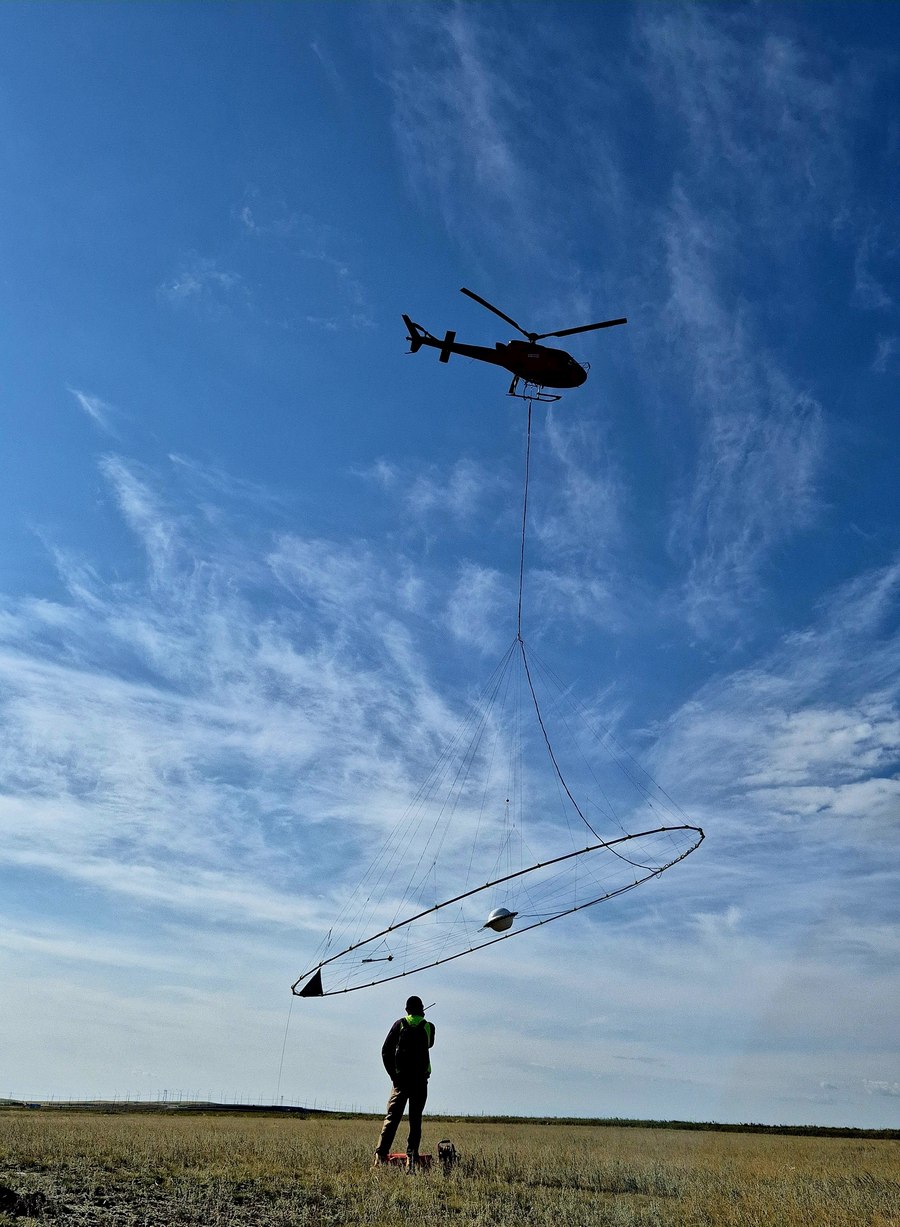
Airborne geophysical mapping is complemented by satellite remote sensing. You can compare this to how medicine uses X-rays, MRI, and ultrasound to scan the human body. Similarly, we use different sensing technologies to scan the subsurface. Kazakhstan still has geological data from the 1960s and 1970s that may be accurate, but it has not been digitized and the geophysical data is very outdated. Again, it’s like comparing an old X-ray to a modern MRI - the capabilities today are far more advanced.
That’s why this project is so important. Modern technologies applied to natural resource mapping can reveal opportunities that were simply invisible with older methods. Much of the historical data doesn’t reflect current technological possibilities because the tools didn’t exist at the time.
Xcalibur Smart Mapping currently operating in 15 countries and responsible for nearly 90% of such projects worldwide. We work in both developed countries like Australia - which has invested in geophysical data for over 40 years - and developing nations such as the Democratic Republic of Congo and Zambia, where we’re conducting full national mapping. Zambia, part of the resource-rich African Copper Belt, is rapidly emerging as a leader in mineral exploration. Once completed, Zambia will have the world’s most advanced regional geophysical data platform. Major global mining companies are actively engaging with the Zambian government, recognizing that high-quality data reduces investment risk. Interest is also growing from the EU, the U.S. government, and Chinese firms, with companies like Ivanhoe Mines already signing agreements to explore large areas.
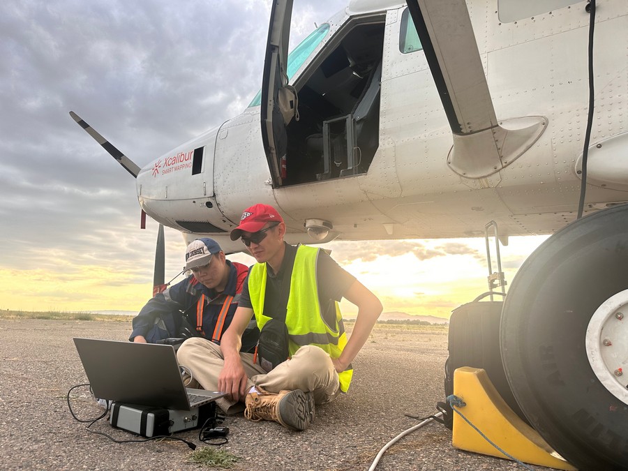
This is exactly why the regional-scale mapping project in Kazakhstan is so critical. At the moment, Xcalibur Kazakhstan is already providing services to subsoil users and investors. Our aircraft is currently operating in Taraz.
At the same time, we are in active discussions with the Ministry of Industry and Construction regarding the possibility of launching airborne geophysical mapping in the Northern Pribalkhash region, as well as expanding to cover the entire country.
- What is the current stage of the project?
- We are currently working on the technical definition and the funding structure. There are usually three ways to finance such programs. In very wealthy economies - like Australia, Canada, the U.S., Saudi Arabia, and Brazil - governments typically fund these programs themselves. In developing countries, funding is usually secured through bilateral or multilateral financing arrangements.
In large countries we divide the work into phases. We begin with the areas that show the highest potential. These are mapped first, and the resulting data is then used to attract investors and generate tax revenue for the government. These inflows can then help fund the continuation of the program in other regions of the country.
We are currently operating in Taraz, conducting work for private clients. At the same time, there are certain procedural and bureaucratic steps that need to be completed, so this matter is being addressed in coordination with the Ministry. That said, we are engaged in an open dialogue and hope to sign a contract in the near future to begin the first pilot phase of the project in Kazakhstan, in cooperation with the Geology Committee, focused on airborne geophysical surveying.
There are some formalities that still need to be finalized, and we are actively working through them.
- How long will the national airborne geophysical survey take?
- It depends on the available capacity. But as a company with a fleet of over 40 aircraft, we are prepared to deploy up to 10 planes in Kazakhstan. The key factors are ensuring there is sufficient volume of work and appropriate funding in place.
- Will it be possible to start this year?
- Well, we hope so. We are the only company in the world capable of deploying 10 systems here and mapping the country very quickly.
- You mentioned that in large countries like Kazakhstan and Congo, you divide the work into several phases. That is, you first identify the areas with the greatest potential, study those regions initially, and then expand from there. In Kazakhstan, which regions do you see as the best starting point? Where do you see the highest potential for launching the survey?
- According to our current plan, we intend to begin with the Northern Balkhash area and the surrounding regions - an area totaling approximately 260,000 to 270,000 square kilometers. Once this region is thoroughly mapped at a regional scale, it will attract a significant number of investors. Because this area has strong geological potential and already hosts some active operations. When you combine active development, promising geology, and high-quality data, the investment risk is significantly reduced - making it much easier for investors to engage and commit capital.
If we’re talking specifically about critical minerals, then our focus is on conducting airborne geophysical surveys in the Chyu-Saryusy province, which includes Northern Pribalkhash, and potentially in the Teniz basin as well - both areas of interest for critical minerals.
If we shift to oil and gas, then Western Kazakhstan - particularly the Aktobe, Atyrau, and Mangystau regions - would be the main focus.
As for water mapping, that could be implemented in multiple regions across the country.
Regarding the pilot project, we plan to start in Northern Pribalkhash and gradually extend into the Kalba-Naryn basin in eastern Kazakhstan. There are strong indications that rare earth element deposits may be discovered in the Kalba-Naryn area. This entire zone - from Northern Pribalkhash to Kalba-Naryn - is considered a treasure trove of critical minerals. Several known deposits are already located there, including Konyrat and Aktogay. Our mapping will help define the structure and depth of these and other potential mineral deposits in the region.
- Does the government of Kazakhstan have specific priorities - for example, a focus on critical and rare earth minerals - or is the goal simply to create a comprehensive national resource map?
- Usually, the Ministry of Industry focuses more on critical minerals and mining potential, as this area remains underdeveloped in the country. In contrast, oil and gas development is typically driven by the oil and gas companies themselves, which run their own exploration programs.
In this case, I would say the Ministry and the Geological Survey are clearly prioritizing critical minerals and mining potential. Additionally, we are working with the Ministry of Water Resources and Irrigation of the Republic of Kazakhstan on developing a project to map underground water resources, which is expected to become a major issue in the future - not only in Kazakhstan, but globally. As you know, water will be a critical challenge in the years ahead. At the moment, as we discussed earlier, the key focus is on funding. The government must decide whether to finance the program directly or proceed with external financing options.
We have already secured funding for the initial phase - the Balkhash area - through bilateral financing from the Spanish government. We've also held early-stage discussions with the EBRD about the possibility of financing the rest of the program.
Importantly, we already have a letter of commitment from the Spanish government to finance the first phase. Now it's up to the Kazakh government to decide whether to move forward with that financing - and that’s part of the ongoing dialogue.
- So as I understand it, there’s an agreement with the Ministry to create a similar map for underground water resources, just like the one for mineral reserves?
- Yes, we have signed an MoU with the Ministry of Water Resources and Irrigation of the Republic of Kazakhstan and defined a pilot project in the Kokzhide area. The goal is to map underground water resources using airborne geophysics - the same method we are using in Australia, where we’re mapping the entire interior, and in California, where we’re locating underground reservoirs.
Regarding Northern Pre-Balkhash, the Spanish government has agreed to provide funding - even with a grace period - although this depends on intergovernmental debt arrangements. For water-related projects, we are exploring EU grant funding, while grants for mining and critical minerals are harder to obtain, as these sectors are expected to generate revenue. However, we successfully implemented a financing model in Tanzania that combined Spanish bilateral funding with an EU grant for mineral mapping, and we believe this approved framework could be replicated in Kazakhstan as well.
- What is the timeline you are setting for creating the map?
- We were very clear in our proposal to the government. We told the government that the first phase - Northern Pre-Balkhash - can be completed in about a year and a half, and the entire country within six years.
- What is the estimated cost of such work?
- The cost is still under discussion, but for comparison, Zambia allocated $93 million to map 750,000 km² - one of the most advanced projects globally. In Kazakhstan, over $1 billion is was spent over the period of the last 5 years on geological exploration, and around 3,000 licenses have been issued. If a nationwide survey is carried out, that number could grow significantly. Even if the mapping costs $300 million - or less - the return in investor obligations, regional investments, and training would far exceed the cost, not to mention the potential discovery of new deposits.
- Will you conduct the survey independently or involve local partners? Will you use existing data, and is technology transfer to local companies part of the government’s conditions?
- Yes, local content and technology transfer are central to our approach. One of the main reasons for establishing a local company in Kazakhstan is to build a strong national team and train local specialists. We’ve already signed agreements with universities and plan to launch the Xcalibur Lab - an R&D center focused on technology development, including AI applications in natural resources.
Our team at Xcalibur Kazakhstan has already proven itself internationally - for example, by successfully completing a project in Saudi Arabia. As project volumes grow, we expect more Kazakh professionals to join and eventually work across our global network, which includes 16 offices worldwide.
We’re also open to cooperation with local companies that bring relevant expertise. While it’s rare to find partners with more advanced technology in our sector, we’re fully prepared to collaborate - especially if this is required by the government.
That said, our priority is to develop a strong regional hub in Kazakhstan that can apply world-class technologies not only within the country but also across Central Asia.
One of our core technology development areas is the integration of artificial intelligence and machine learning into geological exploration. Like in healthcare or automotive industries, AI has enormous potential in natural resources. We've been developing and training our own AI model over the past three years using proprietary datasets to interpret large volumes of geophysical data more efficiently.
In partnership with Stanford University, we’ve focused on using AI to reduce both data volume and processing time. For example, we aim to achieve the same resolution with 400-meter flight line spacing as we currently do with 200 meters - cutting data requirements in half. While commercial deployment is still ahead, the technology is showing strong promise in accelerating early-stage exploration and identifying high-potential areas more accurately.
The first application, as mentioned, is to reduce the cost of data acquisition and processing by decreasing the amount of data needed to achieve the same results - by up to 50%, or at least 40%. This directly impacts processing efficiency and leads to both time and cost savings.
The second application is at the regional level: improving the efficiency of identifying high-potential target areas by comparing geological structures with others that have proven successful in different parts of the world. We analyze geological structures worldwide and compare them with those we map - such as in the Balkhash region - to improve the model’s accuracy in identifying promising targets.
The third application involves using AI to analyze a mapped geological structure and compare it with similar formations globally, then assess the economic outcomes those structures have produced. The goal is to infer a range of potential economic outcomes, which can then be used as collateral to attract funding or investment.
To support this effort, we aim to establish a regional AI and Machine Learning hub in Kazakhstan through Xcalibur Kazakhstan, in collaboration with local partners. Our vision is for Kazakhstan to become the hub for AI and ML across Central Asia.
Developing a mine from discovery to full production usually takes 10 to 25 years. We see a major opportunity to reduce this timeframe, especially at the greenfield exploration stage, by combining high-quality data with AI and machine learning. This could shorten the process to 10–15 years.
In underexplored areas, where major discoveries are still possible, this approach is especially valuable. We believe Kazakhstan has the potential to become a global leader in energy transition resources. While not yet at the level of Australia or Canada, it could emerge as a top-three or top-four player globally, driven by its companies and natural potential.
We believe Kazakhstan can become a global leader in the energy transition because it shares the same three key strengths as countries like Canada and Australia: strong resource potential, competitive local companies, and a stable legal framework. Kazakhstan has vast natural resources, a growing base of local champions, and Subsoil and Subsoil Use Code of the Republic of Kazakhstan was modeled after Australia’s.
With the right government support and strategic focus, Kazakhstan could rank among the top five global players in the next 10–15 years. We’re already expanding regionally, with successful operations in Mongolia and plans for Uzbekistan and Kyrgyzstan.
- As I understand it, the goal in Kazakhstan is to establish it as a base for Central Asia - a central hub for major projects in the region. So from here, you would be launching and managing projects across neighboring countries. Could you please elaborate on that? What are your plans? Which countries are you targeting? Will similar work be carried out in those countries - for example, in Uzbekistan or Kyrgyzstan - whether related to underground water mapping or mineral exploration?
- We are planning to provide services from our Kazakhstan office to all neighboring countries - whether for governments or private companies. These services will cover a range of sectors, including mineral resources (both critical minerals and traditional mining), hydrocarbons, hydrogen, geothermal energy, and underground water.
Today, we have four major offices: in Australia, South Africa, Spain, and Canada. The next key offices we are in the process of developing are in Kazakhstan (covering Central Asia), Brazil - where we have a major contract to map the country - and the Middle East. These three locations are currently our main focus for expansion.
- Thank you for your time!
July, 2025
© 2026 Interfax-Kazakhstan news agency
Copying and use of these materials without reference to the source is prohibited
Archive
